Heightmap (DEM)
A heightmap entity is a special type of Ortho-Imagery set where images describe altitude instead of color. The images for these sets must be in 16bit grayscale PNG format.
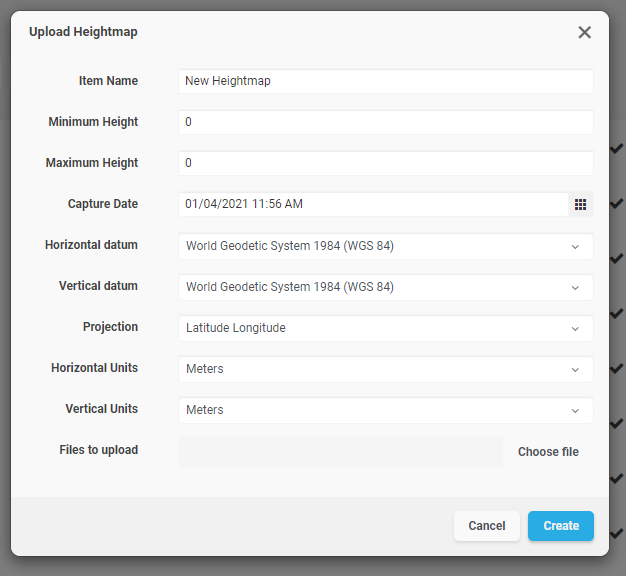
Once you select “Heightmap” from the “Add” menu, you will see the following options:

|
Item Name |
A readable name for the new entity |
|
Minimum Height |
Elevation value for black pixels in the heightmap |
|
Maximum Height |
Elevation value for white pixels in the heightmap |
|
Capture Device |
An optional string to identify capture device |
|
Capture Date |
An optional field containing the original capture date |
|
Horizontal Datum |
The horizontal datum used in the heightmap |
|
Vertical Datum |
The vertical datum used in the heightmap |
|
Projection |
The projection used by the heightmap |
|
Horizontal Units |
The horizontal unit type used in the heightmap |
|
Vertical Units |
The vertical unit type used in the heightmap |
Click “Choose Files” to select which files to upload as the Ortho-Imagery set. Each image in the set is expected to have a matching world registration file. The following table lists the supported image formats and the expected world file extension for the format:
|
Image Format Extension |
Expected World File Extension |
|
.PNG (16bit grayscale) |
.PGW |
You can also select multiple archive ZIP files, which should contain the image and matching world registration files.
Click on “Create” to begin the upload process. You can track the upload operation from the “Pending” section in the project’s page.